The Disappearing Act of the Great Salt Lake
The Great Salt Lake Area
Utah’s Great Salt Lake is a large, shallow lake with a highly volatile surface area that averages around 1,700 square miles. It’s sourced mainly from annual precipitation and fed by the Bear, Weber, and Jordan Rivers. Since it has no outlet, it maintains a very high mineral concentration as water evaporates from the basin.
The lake plays an important ecological role for a large variety of species. The salty lake is home to brine shrimp and brine fly as well as algae and other microorganisms. The wetlands cycle nutrients, provide a flood buffer, and support biodiversity in an otherwise arid region. It’s located along the Pacific Flyway, serving as a feeding, nesting, and resting ground for millions of migratory birds in hundreds of species every year. Additionally, the lake helps moderate local temperatures and reduce dust pollution that would arise if the lakebed dried out.
Despite the variety of species and communities depending on it, the Great Salt Lake is shrinking. The Utah Geological Survey team is working to identify the cause. There are two main suspects. The first is evapotranspiration. Evaporation has always been a natural part of the Great Salt Lake, but tracking its rate over time is key to understanding whether it has accelerated. The other factor is a grass-like weed called phragmites. Phragmites invaded the lakebed in the 90s and have spread rapidly. This species requires a lot of water to thrive, draining the wetlands.
Methodology
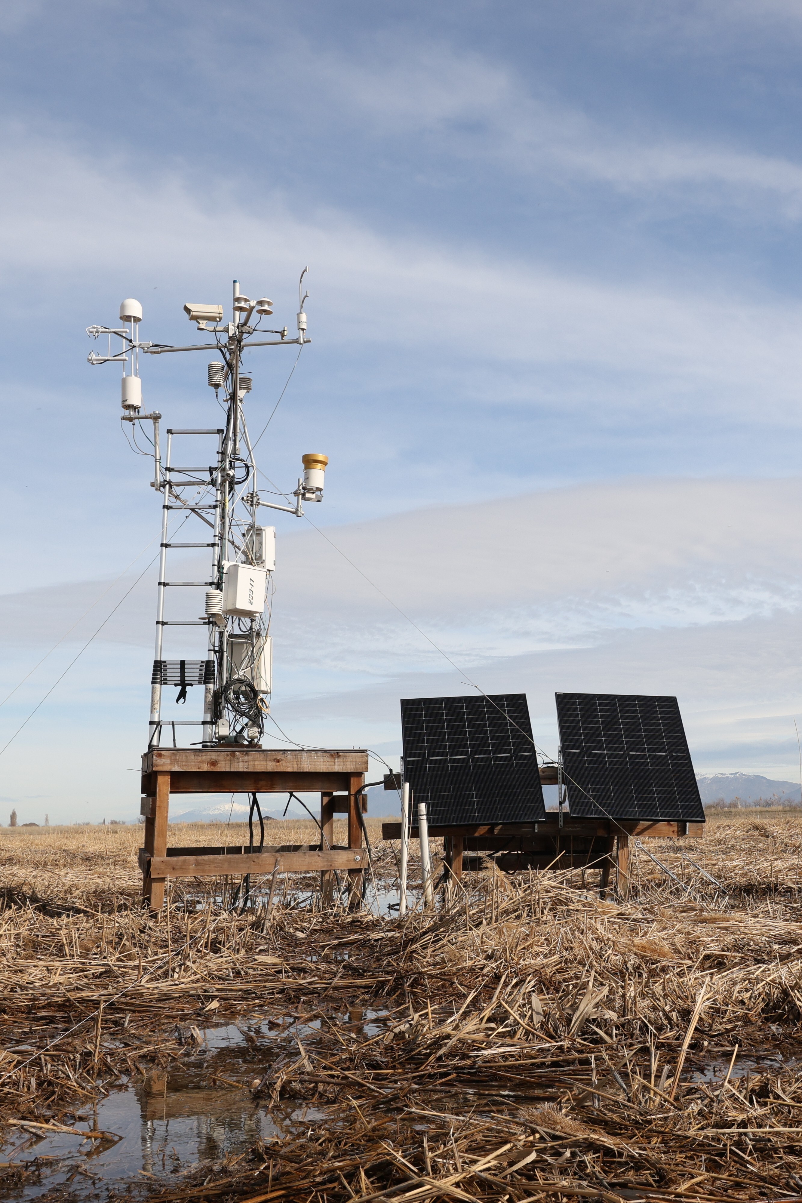
Energy balance accounts for all the energy entering and leaving a given area, which tells researchers how much energy is available to evaporate water. When more energy is absorbed by the land or water surface, more evaporation occurs. Paul Inkenbrandt from the Department of Natural Resources explained that for this research, they have set up stations to obtain this data, utilizing Apogee’s Net Radiometers to measure the total incoming longwave and shortwave radiation from the sun and how much is reflected from the ground. They compare the data obtained from these stations to estimates provided by satellites. If the satellite data is correct, they can use it for the entire Great Salt Lake area, rather than needing stations set up at short intervals all across the lake to get frequent pockets of data.
The network has appreciated the reliability and ease of using Apogee’s net radiometer on this project. Its SDI-12 protocol allows all four sensors to share just three lead wires — simplifying installation and reducing potential points of failure in the field. After five years of deployment and collecting research-grade data, the instruments have required little maintenance and have experienced no observable measurement drift — a significant advantage for a long-term study in such a demanding environment.
Impact
Not only is their goal to simply understand where the water is going, this organization wants to practice good water management, keep the lake at healthy levels, manage the ecosystems in and surrounding the lake, and help the people of Utah.
Measures incoming and outgoing
Comprised of an upward-looking and downward-looking pyranometer, and an upward-looking and downward-looking pyrgeometer, all heated.